
Mackenzie Basin, New Zealand: Photographing the High Country
Mackenzie Basin, New Zealand: tussock, glacial lakes, braided rivers and autumn trees, with drone rules and the dark sky.
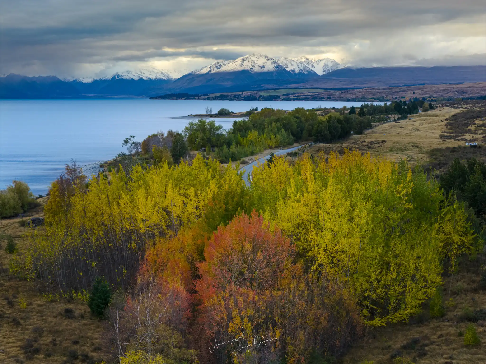
The Mackenzie Basin, New Zealand, is a high, wide bowl of tussock grassland in inland Canterbury, ringed by the Southern Alps and other ranges and holding three large glacial lakes, Tekapo, Pukaki and Ohau, along with braided rivers, hydro canals and the small towns of Lake Tekapo and Twizel. For photographers it means big skies, tawny hills, turquoise water and autumn trees, and some of the darkest nights in the world inside the Aoraki Mackenzie International Dark Sky Reserve.
Lake Tekapo is the usual base for the basin, and our Lake Tekapo photography tour guide covers the lake, the church and the night sky. This article steps back to the landscape around them, as we photographed it on our autumn visits, partly from the ground and partly from the air.
Mackenzie Basin, New Zealand: the landscape
The Mackenzie Basin is the largest intermontane basin in New Zealand, a plateau of open country between the main divide of the Southern Alps and the ranges to the east. Glaciers carved the valleys at its head and left the big lakes behind moraines, and the rivers that drain them spread out over wide gravel beds in shifting, braided channels. The vegetation is mostly tussock grassland, pale gold for much of the year, broken by shelter belts of pine and stands of willow and poplar planted by the sheep stations. That simplicity is the appeal: a few strong colours, long lines and a lot of sky. Light moves across the basin quickly, with cloud pouring over the alps from the west and burning off over the plains, so the same hillside can look completely different within an hour.
The three lakes
Lake Tekapo, in the north-east of the basin, is the lake with the town, the Church of the Good Shepherd and Mt John Observatory above it. Lake Pukaki, further west, is larger and emptier, with the same milky blue colour and Aoraki/Mount Cook standing at the head of its valley on a clear day. Lake Ohau, in the south-west, is the quietest of the three. All three take their colour from glacial flour, rock ground fine by the glaciers and held in the water. Around them sit smaller lakes and ponds, many of them on private land or in reserves, which often give the calmest water and the best reflections.
| Place | What you photograph | Best light |
|---|---|---|
| Lake Tekapo | Church, willows, lakeshore, night sky | Morning, dusk, moonless nights |
| Lake Pukaki | Blue water with Aoraki/Mount Cook beyond | Clear mornings and late afternoons |
| Smaller lakes and ponds | Reflections, autumn trees | Still early mornings |
| Braided rivers | Patterns of gravel and turquoise channels | Low side light |
| Tussock hills and passes | Gold grass, snow on the ranges | Low sun, after snow |
The table is a starting point; in the Mackenzie the weather chooses the subject more often than the plan does.
Autumn in the basin
In autumn the introduced trees of the Mackenzie Basin, willows, poplars and larches, turn yellow and orange against the dark pines and the straw tussock, and the lake edges become bands of colour. The card picture of this article shows that moment: a slope of autumn trees above a lake shore with snow on the far ranges and cloud lying low over the water. From a height the shapes become clearer, with lines of trees following old fence lines, streams and the edges of lagoons. Our Lake Tekapo in April article covers the autumn season in more detail.
Photographing the basin from the air: the rules
Aerial pictures of the Mackenzie are striking, but drones here are tightly controlled, and they should be. The Civil Aviation Authority's Part 101 rules apply to every drone under 25 kilograms, including limits near aerodromes, and the Department of Conservation requires a concession, a permit, to fly from or over conservation land, which includes national parks such as Aoraki/Mount Cook. The Church of the Good Shepherd's notice adds that no drones are allowed around the church or anywhere in Lake Takapō village, because there is an airport nearby. Keep well away from wildlife, ask landowners before flying over private stations, and remember that a scenic flight from the local airfields is a legal and spectacular alternative.
"The Mackenzie taught me to look down as well as out. From a little height the tussock, the water and the trees turn into shapes and colours, and the basin becomes a painting. On the ground, the same place is about the sky."
Joseph Mak, tour leader, Unusual Expedition
Colour in close-up
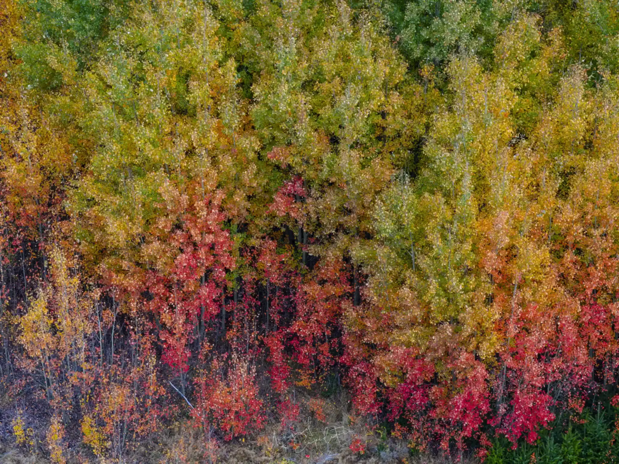
Not every aerial picture needs a horizon. Looking straight down on a stand of autumn scrub, the reds, oranges and yellows fill the frame like a fabric, and the picture works on colour alone. The same idea works on foot with a telephoto: pick out a slope of trees on the far side of a lake and let the pattern fill the frame. These abstract frames sit well beside the wide views in a set, and they are possible on grey days, when the big landscapes are flat.
Mackenzie Basin NZ: weather and roads
The Mackenzie Basin sits in the rain shadow of the Southern Alps, and Tourism New Zealand describes inland Canterbury and Otago as among the driest parts of the country, but it is also exposed: strong north-westerly winds, hard frosts and, in winter, snow that can close the passes for a time. Roads are good and quiet, but distances between fuel stops are long and the light is so tempting that it is easy to stop everywhere. Pull fully off the road, use the marked lay-bys and never stop on a bend. Check the road status before crossing the Lindis Pass or heading to Aoraki/Mount Cook after snow.
The night over the basin
The Aoraki Mackenzie International Dark Sky Reserve covers much of the basin, from Lake Tekapo to Twizel and Aoraki/Mount Cook, and on a clear, moonless night the sky is extraordinary in every direction. Our Lake Tekapo stargazing article explains the reserve, the timing and the settings, and Lake Tekapo things to do lists what else fills a stay in the basin.
Photograph the Mackenzie Basin with us
Our New Zealand South Island Winter Photography Tour 2027 crosses the Lindis Pass into the basin, spends two dark-sky nights at Lake Tekapo, works the blue of Lake Pukaki and goes to Aoraki/Mount Cook before returning to the Southern Lakes. The current rate is on the New Zealand photography tours page, and a private tour can follow your own pace.
Ask us about the Mackenzie Basin
Join the Lake Tekapo photography tour
New Zealand South Island Winter Photography Tour 2027 departs 07 Aug 2027 To 16 Aug 2027, led by Joseph Mak. Small group, photography first. All Lake Tekapo photography tours.
Explore Lake Tekapo in depth
- Lake Tekapo Photography Tour Guide: Lake Tekapo, New Zealand, Through the LensNew Zealand
- Lake Tekapo Things to Do for PhotographersNew Zealand
- Lake Tekapo Stargazing: Photographing the Dark Sky ReserveNew Zealand
- Lake Tekapo Photos: What the Lake Really Looks LikeNew Zealand
- Lake Tekapo in April: Autumn Colour in the Mackenzie BasinNew Zealand
- Church of the Good Shepherd, Lake Tekapo: Where to Stand, the Light and the RulesNew Zealand
- Best Time to Visit Lake Tekapo: Autumn Colour, Winter Snow and LupinsNew Zealand
Upcoming Photo Tours
- Egypt Photo Tour – EgyptEgypt 12 Dec 2026 To 20 Dec 2026
- Inner Mongolia Winter Owl Photo Tour – ChinaChina 01 Jan 2027 To 04 Jan 2027
- Inner Mongolia Winter Photo Tour – ChinaChina 05 Jan 2027 To 11 Jan 2027
- Mekong And Central Highland Vietnam Photo Tour - VietnamVietnam 16 Jan 2027 To 24 Jan 2027