
Iceland South Coast Highlights: Photo Spots from Seljalandsfoss to Vik
Iceland south coast highlights for photographers: where to stand at Seljalandsfoss, Skogafoss, the plane wreck, Dyrholaey and Vik.
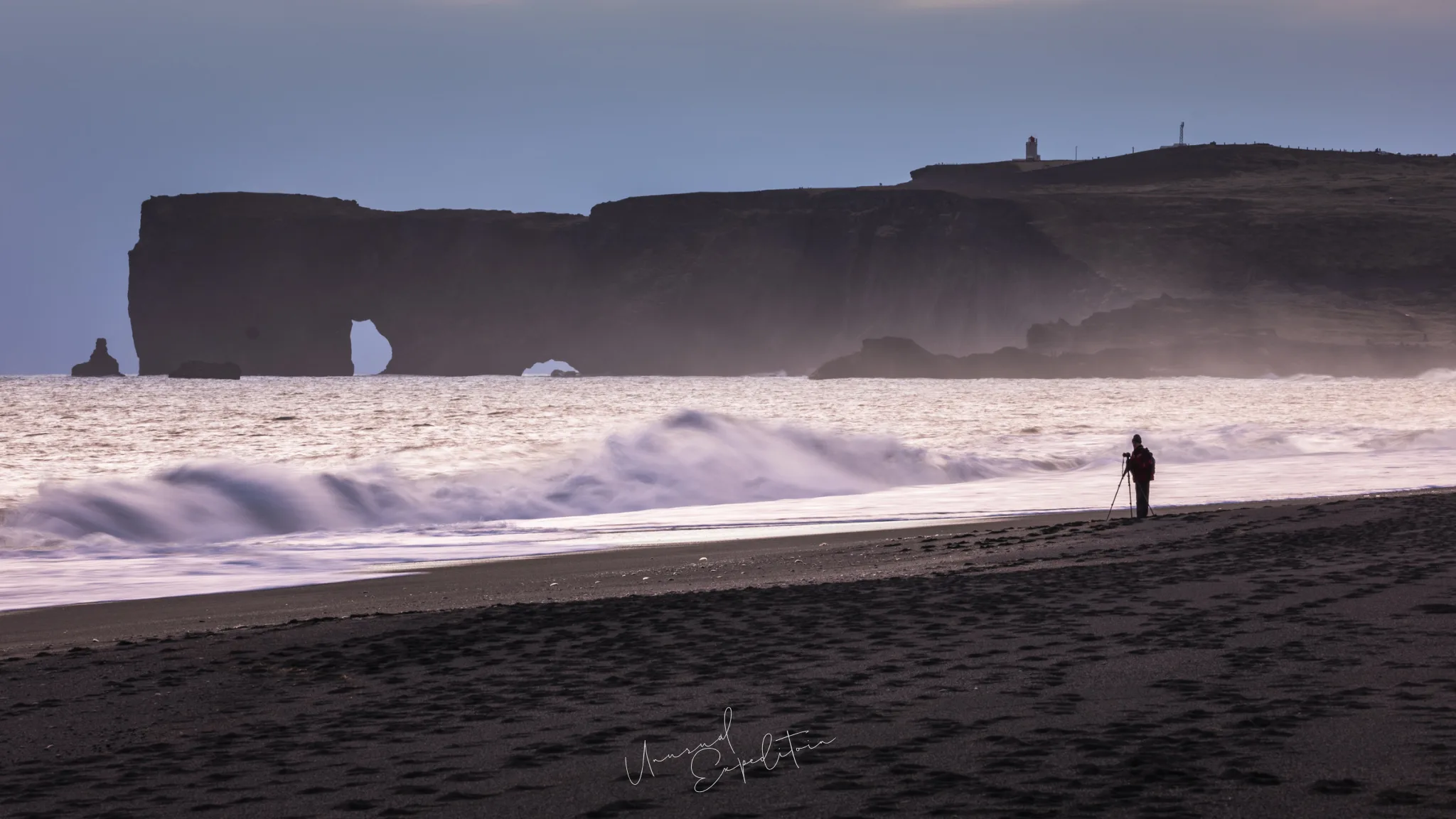
The Iceland south coast highlights for a photographer are seven spots along one road: Seljalandsfoss and the canyon of Gljufrabui, Skogafoss and its stairs, the Solheimasandur plane wreck, the Dyrholaey arch and lighthouse, the Reynisdrangar viewpoint from Reynisfjara, and Vik beach. Each has one or two places to stand that work far better than the rest, and most of them sit close to where the coaches stop.
This is the where-to-stand companion to our South Iceland photography tour guide. The photographs here are our own, taken on our trips along the coast; we hold the rights to them, and the notes come from knowing these places first hand. Entry, money and flights are in the Iceland photography tour guide.
Iceland south coast highlights at a glance
| Spot | Where to stand | Lens | Watch out for |
|---|---|---|---|
| Seljalandsfoss | The path behind the fall, and the meadow in front | 16-35mm | Spray, ice on the path in winter |
| Gljufrabui | Inside the canyon, on the stones by the pool | 16-35mm | Wet feet, mist on the lens |
| Skogafoss | The river bank in front, then the platform at the top of the stairs | 16-35mm, 24-70mm | Spray that soaks everything close in |
| Solheimasandur | Low to the sand, off the main approach line | 16-35mm | Other visitors in the frame |
| Dyrholaey | The upper headland by the lighthouse, and the beach below | 70-200mm, 24-70mm | Nesting season restrictions, cliff edges |
| Reynisfjara | Well back from the surf, by the columns | 24-70mm, 70-200mm | Sneaker waves |
| Vik beach | On the sand below the village, looking west to the stacks | 24-70mm | Wind and blowing sand |
The list is short on purpose: on this coast the difference between a snapshot and a picture is usually twenty steps to one side.
Seljalandsfoss and Gljufrabui
At Seljalandsfoss the photograph everyone wants is from behind, where the path passes under the overhang and the fall becomes a curtain against the sky. Stand at the far side of the loop and let the opening of the cave frame the water. From the front, walk out into the meadow and use the stream as a lead line. A short walk north, Gljufrabui hides in a narrow canyon; you step through a shallow stream to reach the pool inside, so bring waterproof boots. Inside, the canyon is dim and full of spray, so a rain cover for the camera matters more than the lens. Our Seljalandsfoss waterfall guide covers both in detail.
Skogafoss stairs and the river bank
Skogafoss is best from low down on the river bank, far enough back that the whole curtain, 60 metres high and about 25 metres wide according to Icelandtours, fits a wide lens with the gravel and water in front. Walk closer and the spray covers the front element within seconds. The stairs beside the fall climb to a platform above the fall, where you look down the river towards the sea and can follow the path upstream to further waterfalls. On a sunny day stand with the sun behind you to catch the rainbow in the spray.
Where is the plane wreck in Iceland?
The DC-3 wreck lies on Solheimasandur, the black sand plain between Skogafoss and Vik, about 4 kilometres on foot from the car park beside the ring road. There are no cars on the track any more, only walkers and the shuttle. Most visitors photograph it from the path side, head on. Walk around to the far side, get low and use the curve of the fuselage against the empty horizon instead. The Solheimasandur plane wreck guide has the angles and the light.
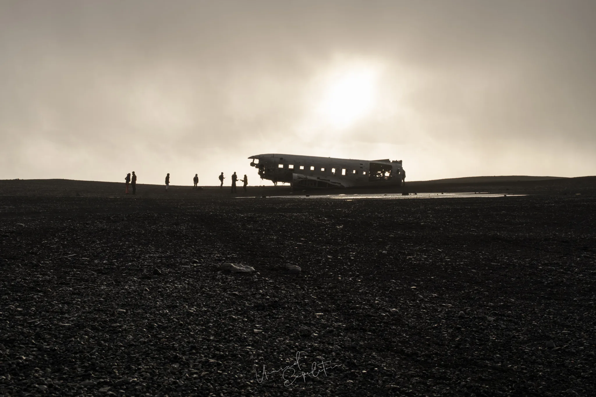
Dyrholaey arch and lighthouse
Dyrholaey is a promontory with a great sea arch at its tip, a lighthouse on the upper headland and long views both ways along the coast. From the top you look east over Reynisfjara to the Reynisdrangar stacks and the rock pillar of Arnardrangur below; from the beach at Reynisfjara you see the arch side on, with surf running through it. In late spring and early summer access can be restricted to protect nesting birds, as the South Iceland tourism office points out, so check the signs and the official notice before you plan a dawn there.
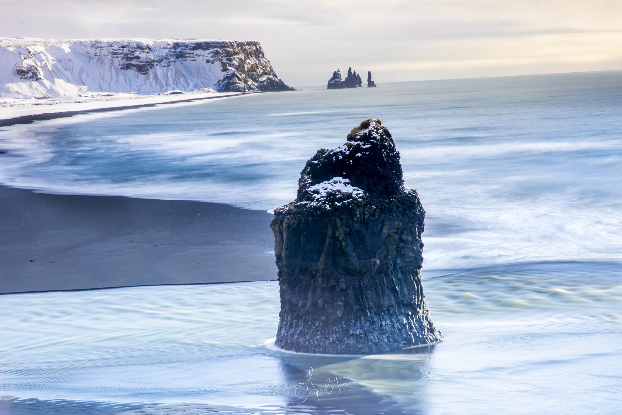
Reynisdrangar viewpoint
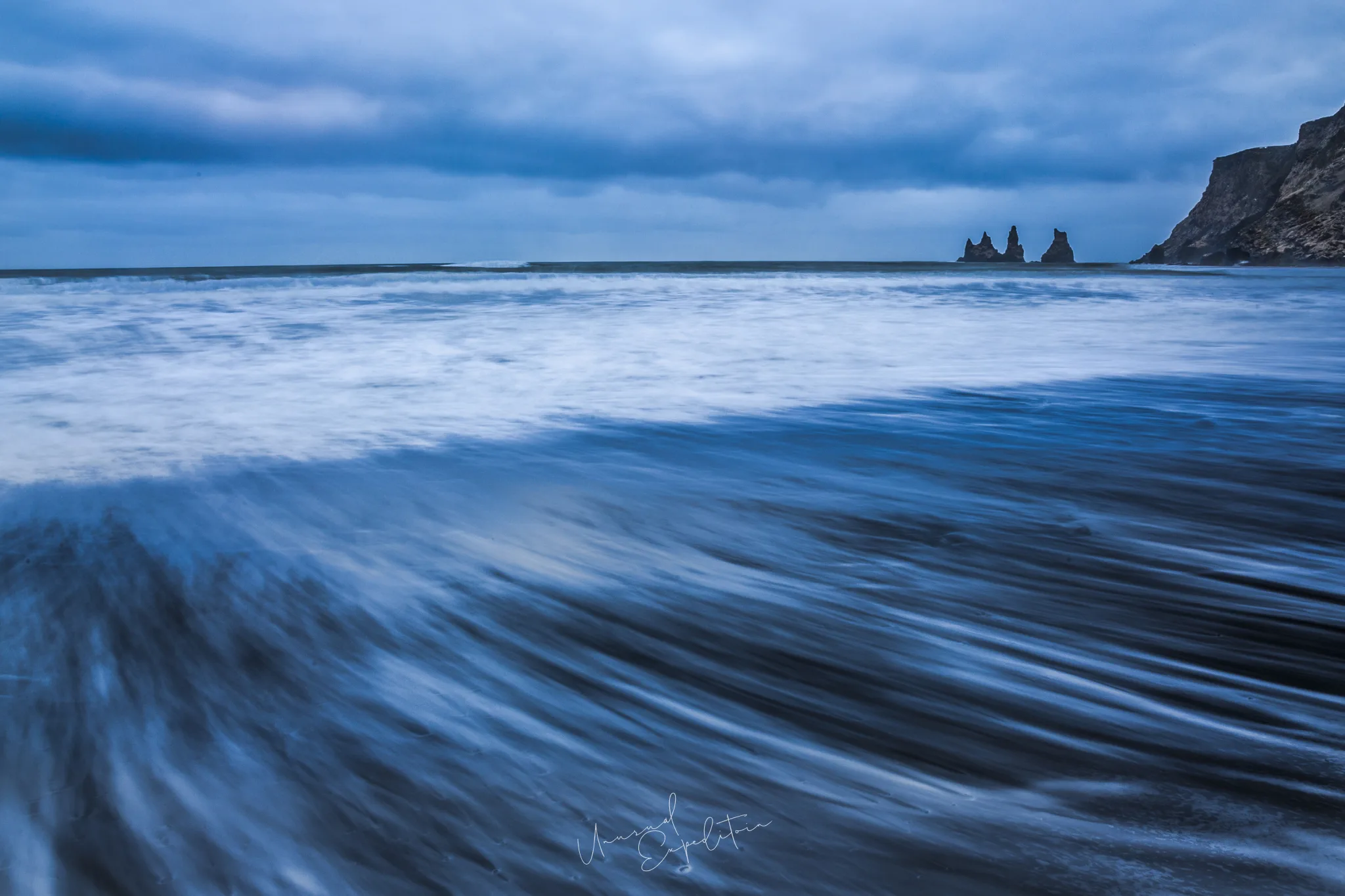
The Reynisdrangar sea stacks can be photographed from two sides. From Reynisfjara, west of the headland, they stand beside the basalt columns and the cliff, close and tall, and a 70-200mm pulls them against the surf. From Vik beach on the east side they line up in a row off the end of Reynisfjall, smaller and more graphic, and the beach in front gives you clean lines of receding water. The Reynisfjara black sand beach guide covers the west side; Vik is below.
On Reynisfjara I tell people to pick their spot before they take the camera out, and to pick it with the waves in mind, not the stacks. The stacks will still be there in ten minutes. The sea decides where you can stand.
Joseph Mak, tour leader, Unusual Expedition
Vik beach
Vik beach runs along the open shore in front of the village, and in the blue hour after sunset or before sunrise it is one of the quietest places on the south coast. Walk out until the stacks sit off the end of the headland, set a slow shutter and let the retreating waves draw lines across the black sand. The beach is exposed to the same Atlantic swell as Reynisfjara, so the same rule applies: keep watching the sea. Visit Iceland's warning about sneaker waves on Reynisfjara holds for every beach along this stretch.
South coast Iceland sites further east: Skaftafell
Beyond Vik the road crosses the lava and the sand plains to Skaftafell in Vatnajokull National Park, where Svartifoss falls over basalt columns at the top of an uphill walk from the visitor centre. Stand on the rocks below the pool and keep the columns whole in the frame. In autumn the birch along the trail turns yellow. Our weather in South Iceland by season guide explains when each of these spots is at its best.
Come and stand in these spots with us
The south coast is the opening stretch of our Iceland Midnight Sun Photo Tour, timed for the long summer evenings when the coach parks are empty. Dates and the current rate are on our Iceland photography tours page. For a winter version, with snow and the chance of aurora, ask about a private tour.
Join the South Iceland photography tour
Iceland Midnight Sun Photo Tour departs 05 Jul 2027 To 18 Jul 2027, led by Joseph Mak. Small group, photography first. All South Iceland photography tours.
Explore South Iceland in depth
- South Iceland Photography Tour Guide: South Coast Waterfalls, Black Sand Beaches and the Golden CircleIceland
- Sunrise and Sunset in South Iceland: Vik, Seljalandsfoss, the Plane Wreck and HaukadalurIceland
- Weather in South Iceland by Season: Winter Snow, Summer Light and Autumn in SkaftafellIceland
- Golden Circle Iceland: Photographing Gullfoss, Strokkur and ThingvellirIceland
- Solheimasandur Plane Wreck: The Walk, the Angles and the LightIceland
- Reynisfjara Black Sand Beach: Basalt Columns, Sea Stacks and Sneaker WavesIceland
- Seljalandsfoss Waterfall: Behind the Fall, in Winter and at SunsetIceland
Upcoming Photo Tours
- Egypt Photo Tour – EgyptEgypt 12 Dec 2026 To 20 Dec 2026
- Inner Mongolia Winter Owl Photo Tour – ChinaChina 01 Jan 2027 To 04 Jan 2027
- Inner Mongolia Winter Photo Tour – ChinaChina 05 Jan 2027 To 11 Jan 2027
- Mekong And Central Highland Vietnam Photo Tour - VietnamVietnam 16 Jan 2027 To 24 Jan 2027