
Xiapu Drone Photography: The Fujian Coast from Above
Xiapu drone photography: sea farms, jetties, mudflat channels, mangroves and fleets from the air, with tide, light and drone rules.
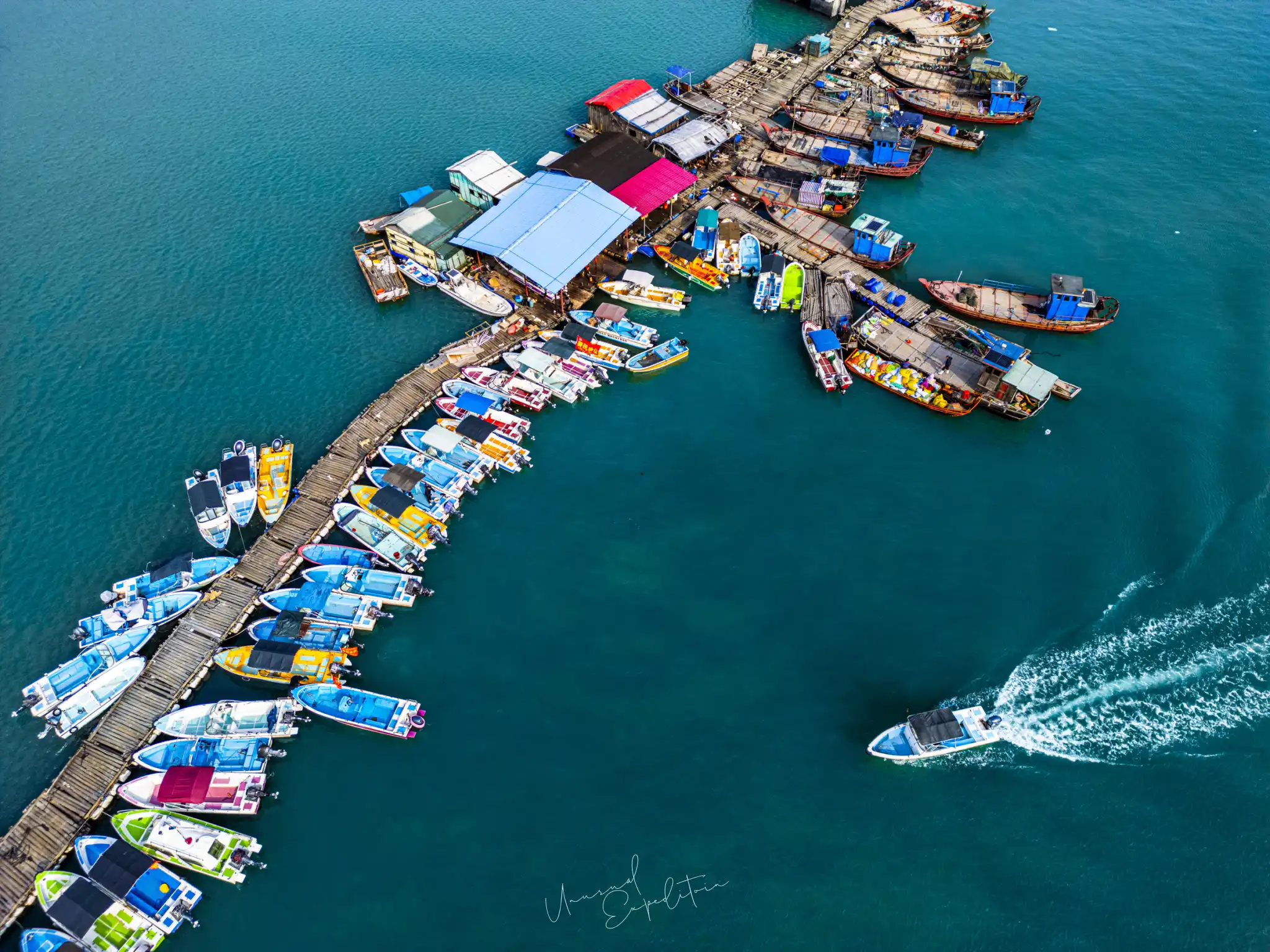
Xiapu drone photography turns the coast of Xiapu county in north-east Fujian into a set of abstract patterns: jetties packed with painted boats, square fish farm cages, long lines of seaweed farms, mangrove islands and harbour villages built out over the water. The best results come from calm air, soft light and the right state of the tide, and every flight has to follow China's drone registration rules. This article is part of our Xiapu photography tour guide.
Most visitors know Xiapu from the ground, from the classic mudflat views of bamboo poles and fishermen at sunrise. From the air the same coast looks like a map drawn by farmers, and that is why so many Chinese photographers now bring a drone as well as a long lens. Below we go through the main aerial subjects, how the tide and the light change them, and what to know before you fly.
What Xiapu looks like from above
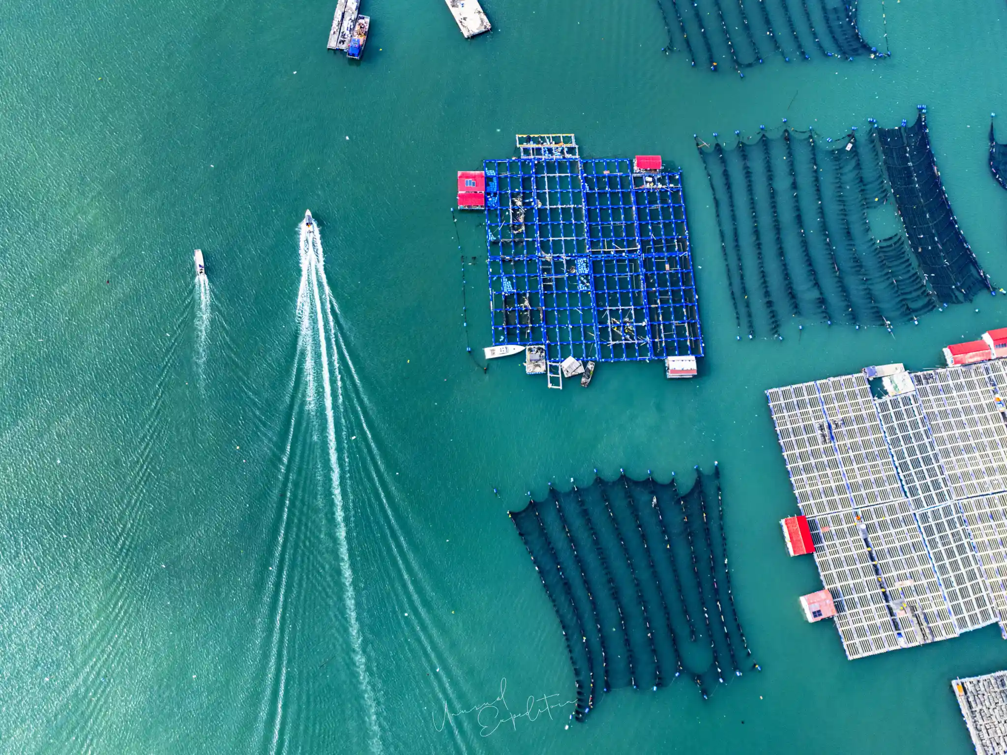
The bays of Xiapu are among the most intensively farmed waters in China. Seen from a drone, the sea is divided into rectangles of floating cages for fish and abalone, rows of buoys for seaweed, and narrow lanes of open water where boats run between the farms. The colours change with the depth and the sediment: turquoise over sand, deep green in the channels, milky brown near the river mouths. Wakes from the small farm boats cut white lines across the pattern, and they are often the element that brings a frame to life. In Xiapu the strongest aerial frames are usually the simplest, with one boat and its wake crossing a grid of cages, shot straight down so that the geometry reads clearly.
Harbours, jetties and stilt villages
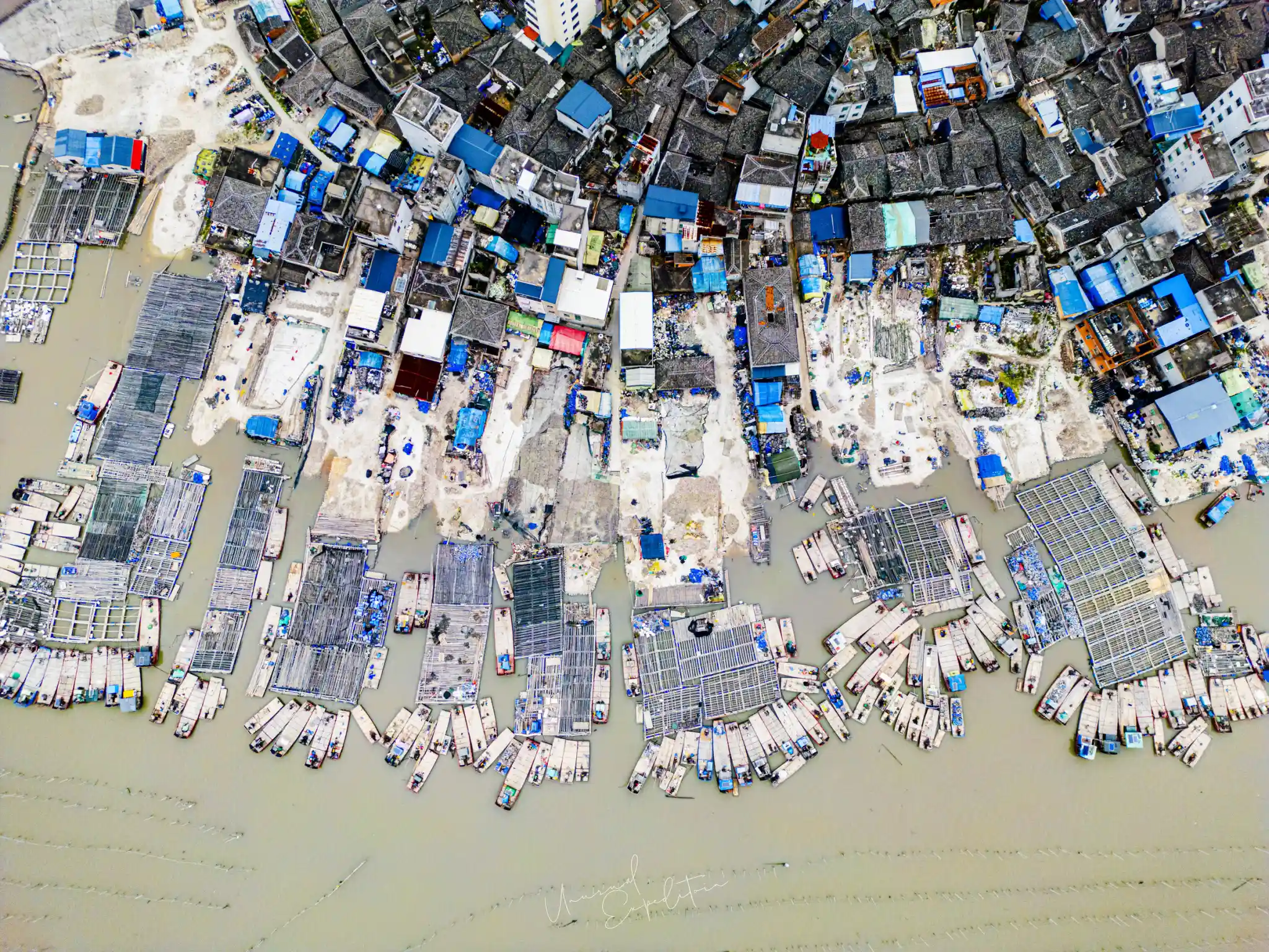
The fishing harbours of Xiapu are the second great aerial subject. Long wooden jetties run out from the shore, lined on both sides with painted wooden boats in blue, red and green, and from above they look like a string of beads. In some harbour villages the houses and work sheds stand on platforms over the water, with boats moored in every gap, and the whole settlement reads as a tight mosaic of blue roofs, nets and hulls. These subjects work best on a bright day with some sun, because the colours of the boats carry the picture. Keep a respectful height over homes and working decks: people below are working, and a drone hovering close over a house is intrusive anywhere.
Xiapu mudflat and mangrove patterns at low tide
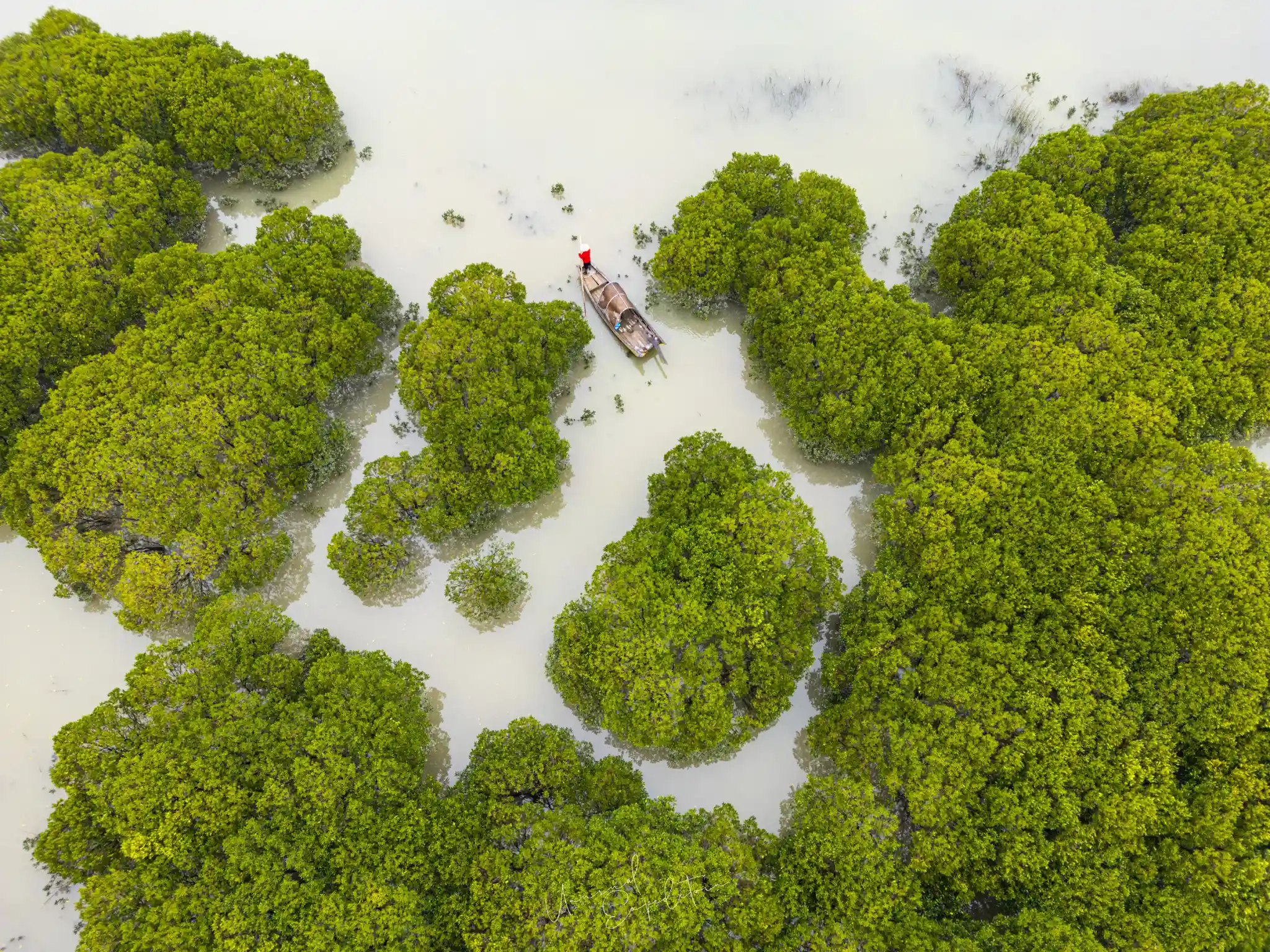
At low tide the Xiapu mudflat becomes a drawing in sand and water. Drainage channels branch across the flats like trees, pools catch the sky, and fishermen with push nets leave tracks behind them. In a few sheltered bays there are mangroves, which from above look like dark green islands floating in pale water, sometimes with a small boat tied up between them. This is the subject where the tide matters most: the patterns only appear in the last part of the ebb and the first part of the flood, so check a tide table for the bay you plan to fly and arrive early. Overcast light is not a problem here; it keeps the sand and water evenly lit and holds the colour of the mangroves.
Fishing fleets at anchor
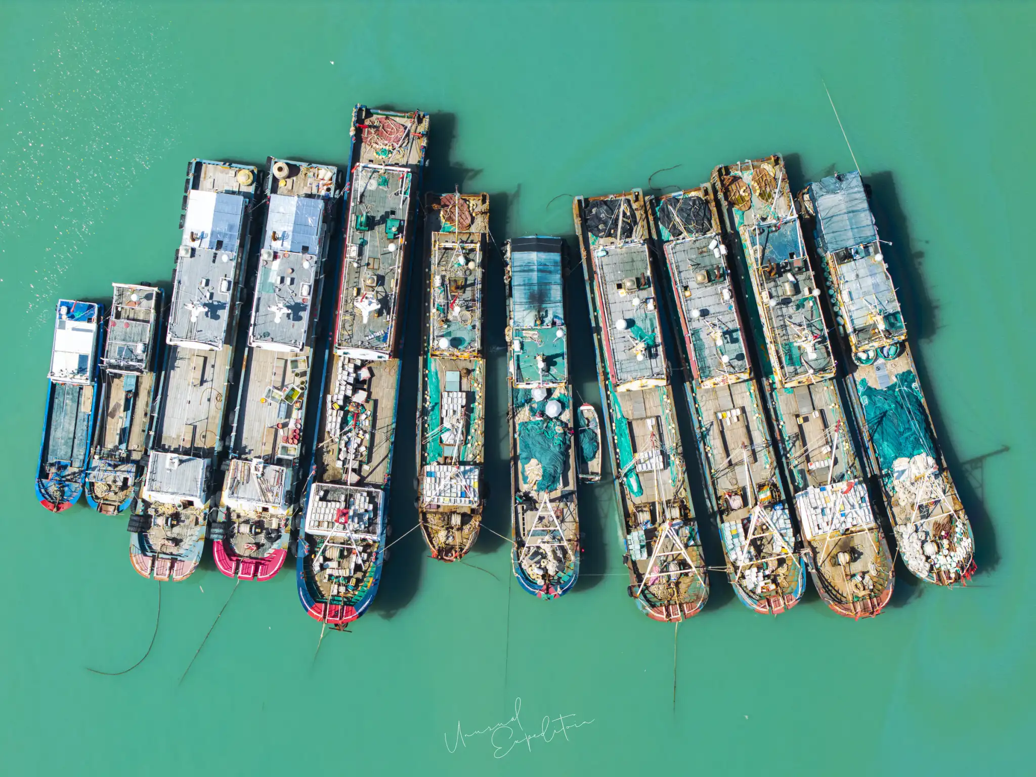
When the fleet is in, the larger steel fishing boats of Xiapu raft up side by side in the bays, sometimes ten or more together. Shot from directly above on calm water, they make one of the most graphic pictures of the coast: a row of decks in rust, white and blue on flat green sea. Fleets are in harbour during fishing closures and in bad weather, so these are subjects you find rather than plan. If you see one, fly it while the water is still; a breeze breaks the reflection and the frame loses its clean background.
"From the ground Xiapu is about light and mist. From the air it is about pattern. The farmers never planned their bays as art, but when you look down on them you see a whole community's work laid out like a painting."
Joseph Mak, tour leader, Unusual Expedition
Light, wind and tide for aerial work
Xiapu sits on an exposed coast, and wind is the main limit on drone days. Mornings are usually calmer than afternoons, and the soft light just after sunrise brings out texture in the mudflats without deep shadow. For straight-down frames of cages and boats, a higher sun is fine, because the subject is colour and geometry rather than relief. Sea fog is common in spring; it can hide everything, or it can lift slowly and leave villages floating above it, which is one of the most memorable aerial scenes in Xiapu. Bring spare batteries, as the best moments are short and a cold, damp morning drains them quickly.
| Aerial subject | Best tide | Best light | Main risk |
|---|---|---|---|
| Fish farm cages and wakes | Any | Bright, high sun | Wind and glare |
| Jetties and painted boats | Mid to high | Sun on the colours | People and homes below |
| Mudflat channels | Low | Soft or overcast | Short tidal window |
| Mangroves | Low to mid | Overcast | Birds nesting |
| Fleets at anchor | Any | Calm, even light | Ripples on the water |
| Villages over sea fog | Any | Early morning | Lost visual contact |
Xiapu drone rules for visitors
China's Interim Regulations on the Flight Management of Unmanned Aircraft, issued by the State Council and in force since the start of 2024, require civil drones to be registered under the owner's real name, and flying an unregistered drone is an offence. Controlled airspace, airports, military areas and some coastal zones are closed to drones, and the app maps can be incomplete for small coastal towns. Rules have been tightened again since, so check the current requirements of the Civil Aviation Administration of China before you travel, and ask locally before flying near ports or installations. Our Xiapu photography trip FAQ covers the practical side of bringing a drone into China.
Combining ground and air
The best Xiapu days mix both. A typical rhythm is a ground position for the sunrise, when the light on the bamboo poles and laver strips is at its best, followed by drone work over the farms and harbours once the light is up and the wind is still low. The ground positions are described in our Xiapu mudflats photo spots guide, and the farms themselves are explained in Xiapu seaweed farms photography. For the people who work this coast, see our Fujian fishing village photos.
Photograph Xiapu with us
We run Xiapu as a private photography trip on request, combined with Xiamen and the tulou. Current China departures are on the China photography tours page.
Join the Xiapu photography tour
Inner Mongolia Winter Owl Photo Tour – China departs 01 Jan 2027 To 04 Jan 2027, led by Joseph Mak. Small group, photography first. All Xiapu photography tours.
Explore Xiapu in depth
- Xiapu Photography Tour: The Complete GuideChina
- Fujian Fishing Village Photos: Xiapu Boatyards, Harbours and Raft VillagesChina
- Xiapu Seaweed Farms: Photographing Laver and KelpChina
- Xiapu Photography Trip FAQ: Getting There, Visas, Drones, TidesChina
- Xiapu Mudflats Photo Spots: Sunrise, Sunset and the Pole BaysChina
- Xiapu Fishermen and She Village PhotographyChina
- Best Time for Xiapu Photography: Laver, Kelp, Mist and TidesChina
Upcoming Photo Tours
- Egypt Photo Tour – EgyptEgypt 12 Dec 2026 To 20 Dec 2026
- Inner Mongolia Winter Owl Photo Tour – ChinaChina 01 Jan 2027 To 04 Jan 2027
- Inner Mongolia Winter Photo Tour – ChinaChina 05 Jan 2027 To 11 Jan 2027
- Mekong And Central Highland Vietnam Photo Tour - VietnamVietnam 16 Jan 2027 To 24 Jan 2027