
Uyuni Photography Tour: The Salt Flats, Lagoons and Geysers
A Uyuni photography tour: the salt flat in mirror and hexagon seasons, Isla Incahuasi, flamingo lagoons, Sol de Mañana and stars.
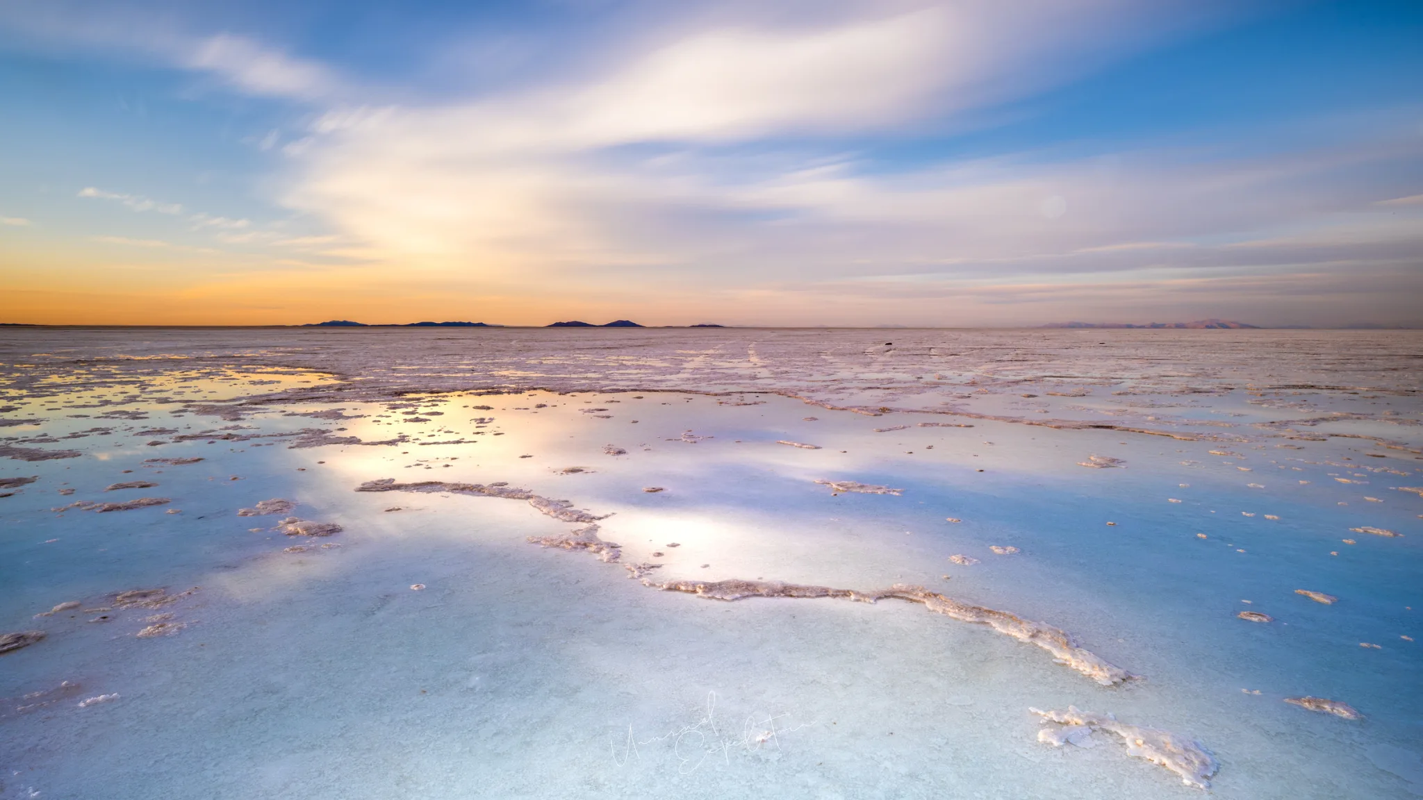
A Uyuni photography tour is a trip across the Salar de Uyuni, the largest salt flat on earth, and on into the high desert of southwest Bolivia, where red and pastel lagoons hold flamingos and the Sol de Mañana geysers steam at first light. The salt gives you two pictures depending on the season: a white crust broken into hexagons, or a sheet of rainwater that turns the ground into a mirror. Below is how the area works for photographers, and where each of our Uyuni destination guides goes deeper.
Uyuni is one region of a larger country. Our Bolivia photography tour guide covers La Paz, Lake Titicaca, entry, money and flights from Singapore once, so this page can stay on the salt and the lagoons. The photographs in this guide are our own, taken on our trips here; we hold the rights to them, and the notes come from knowing these places first hand.
Salar de Uyuni: what you are photographing
The Salar de Uyuni covers about 10,582 square kilometres of the Bolivian Altiplano at roughly 3,656 metres above sea level, according to Britannica, and it is so flat that NASA has used it to calibrate satellites. For a photographer that flatness is the whole subject. In the dry months the surface dries into a crust of raised salt ridges that form polygons, most of them six-sided, running to the horizon. After rain, a few centimetres of water sit on the salt and reflect the sky so cleanly that the horizon disappears. Between the two there is a long middle season of patches: dry crust in one place, shallow water a little further out. Our trip on the salt fell in exactly that middle season, which is why our frames show both. The Uyuni salt flats photos article walks through each kind of picture and where to stand for it.
Uyuni salt flats tour: the four landscapes in one area
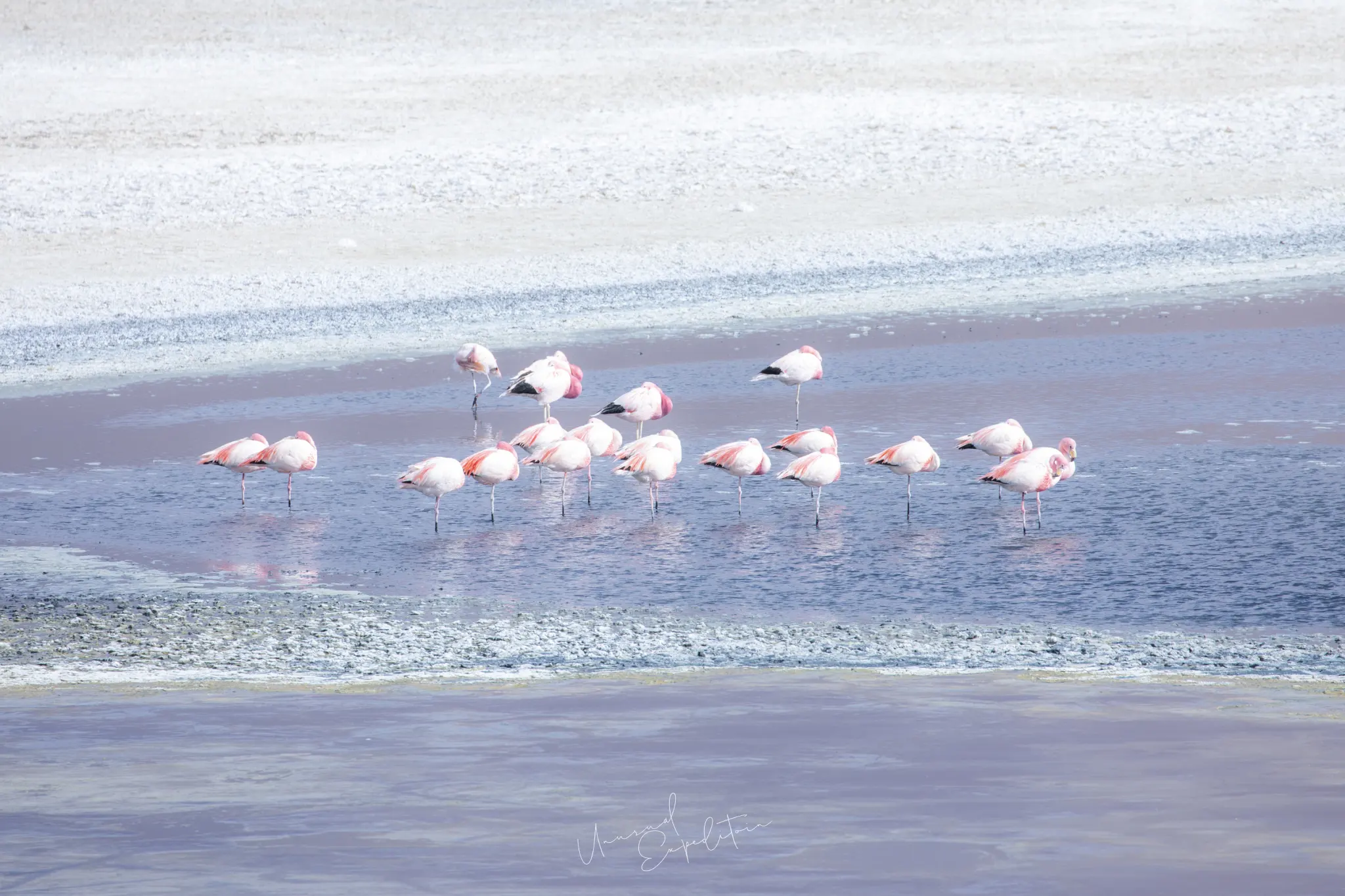
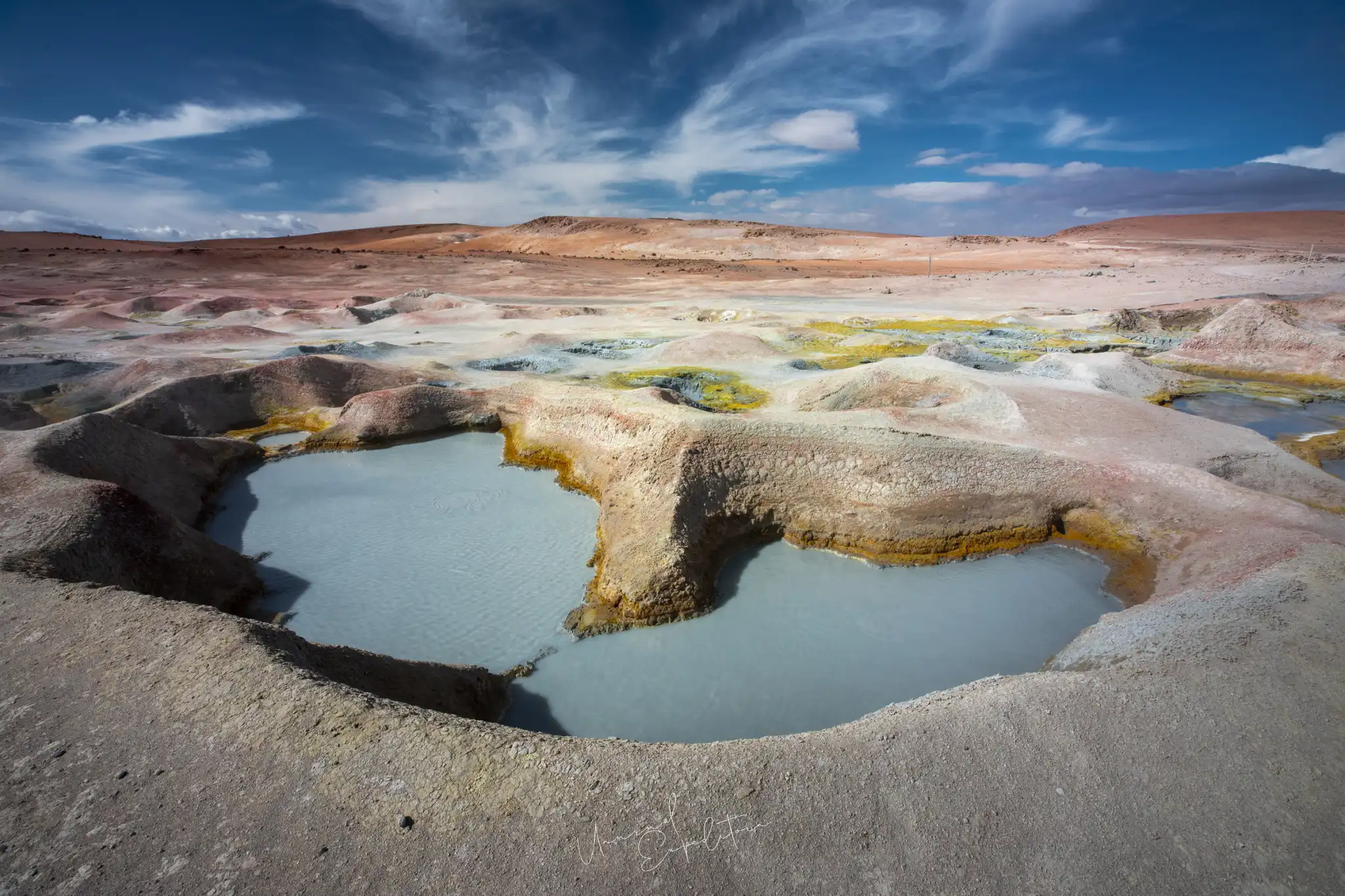
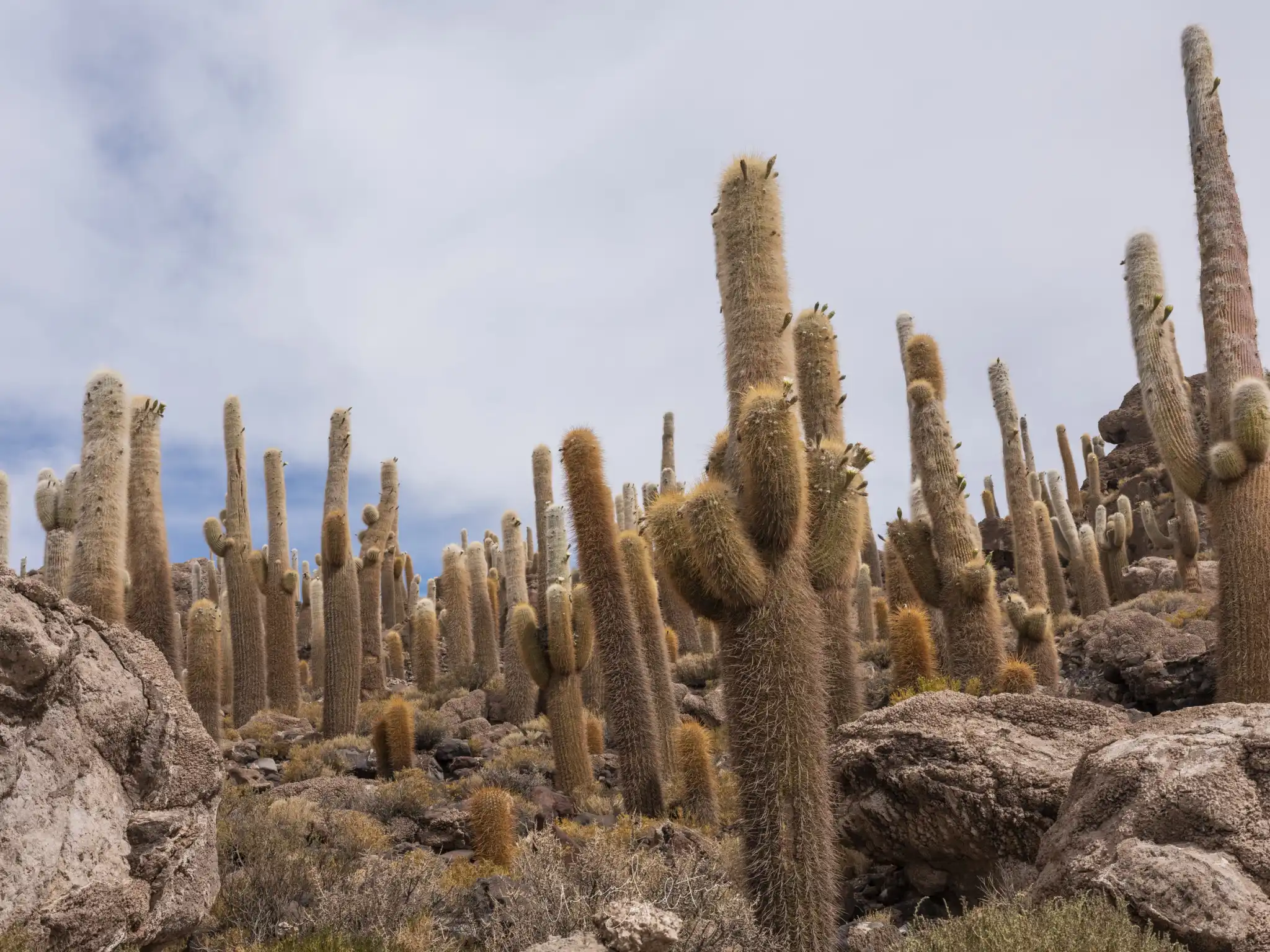
A Uyuni salt flats tour is really four landscapes. The salt itself comes first. Isla Incahuasi, an old volcanic hill in the middle of the flat, carries a forest of giant columnar cacti. South of the salt, the road climbs through the Lípez desert to the high lagoons: still, shallow lakes of white, lilac and red water where three species of flamingo feed. Higher again, on the way towards the Chilean border, the Sol de Mañana geothermal field puts up columns of steam from boiling mud. Each needs a different lens and a different hour, and each has its own article in this set: Laguna Colorada flamingos, Sol de Mañana geysers and Isla Incahuasi and whether Uyuni is worth it.
The Uyuni mirror effect and the dry season
Most people picture the Uyuni mirror: a sky reflected so perfectly that a person on the salt seems to float. That picture belongs to the wet season, broadly December to April, with January to March the most dependable months for standing water. The dry season, roughly May to November, gives clean white salt, sharp hexagons, cold clear nights and easy access to every corner of the flat and the lagoons beyond it. Neither is better; each suits a different kind of picture. Heavy rain can close parts of the flat and some tracks in the wettest weeks, which matters if you want both the mirror and the southern lagoons. We set out the months, the light and the trade-offs in best time to visit Uyuni salt flats.
"On the salt I tell people to stop looking for a subject. The ground is the subject. Get low, put the pattern or the reflection in front of you, and wait for the sky to do something. It always does, usually in the last few minutes before dark."
Joseph Mak, tour leader, Unusual Expedition
Salar de Uyuni at sunset, sunrise and night
The Salar de Uyuni is at its best at the two ends of the day. At sunset the low sun rakes across the salt ridges, so the hexagons pick up gold edges and long shadows. After the sun goes, the sky over the flat holds colour for a surprisingly long time, and on wet ground that colour doubles. Before sunrise there are stars, and in the dry, high air away from towns the Milky Way is bright enough to photograph over the rock formations of the southern desert. Midday on the salt is harsh and white; we use it for perspective pictures, the cactus island and travelling. The Uyuni sunset and night sky article covers exposures, where to set up and how cold it gets.
Photographing the lagoons and Sol de Mañana
The lagoons and geysers of southwest Bolivia sit in and around the Eduardo Avaroa Andean Fauna National Reserve, between about 4,200 and 5,400 metres. Laguna Colorada, a Ramsar wetland at about 4,278 metres, owes its red water to algae and sediment, and it is a breeding ground for flamingos. Sol de Mañana, at around 4,900 metres, is the highest point most visitors reach. The air is thin, the wind is strong after midday and the light is hard, so the best lagoon work is early, when the water is still and the birds are feeding. A 100-400mm lens does most of it. The steam at the geysers is thickest in the cold of early morning, with the sun behind it.
Salar de Uyuni photography tour: what to compare before you go
| Subject | Best light | Main lens | Season notes |
|---|---|---|---|
| Salt hexagons | Low sun, late afternoon and dusk | 16-35mm | Sharpest in the dry season |
| Mirror reflections | Twilight, either end of the day | 16-35mm and 24-70mm | Wet season, standing water needed |
| Isla Incahuasi cacti | Morning or a cloudy sky | 24-70mm | Reachable when the salt is dry enough |
| Flamingos | Early morning, still water | 100-400mm | Present much of the year on the lagoons |
| Geysers | Around sunrise, sun behind the steam | 24-70mm | Cold mornings give the most steam |
| Milky Way | Moonless nights | 16-35mm wide aperture | Clearest skies in the dry season |
Most trips that try to do all six have to choose a season and accept what it does not give.
Altitude, cold and getting to Uyuni
Uyuni town is the gateway to the salt. It has a small domestic airport with flights from La Paz, and a railway and roads from the south. Everywhere in this area is high: the salt sits around 3,656 metres and the lagoon road climbs well above 4,000. Nights drop below freezing for much of the year, and the wind on the lagoons cuts through thin layers. We plan the first days at altitude gently, carry water and warm layers in the vehicle, and keep spare batteries in an inside pocket. Visas, flights from Singapore and money are in the guide to getting to Uyuni, and the country-level detail is in the Bolivia guide.
Explore Uyuni in depth
- Uyuni salt flats photos: what the salt really looks like and where to stand
- Best time to visit Uyuni salt flats: mirror or hexagons
- Uyuni salt flats sunset, sunrise and stars
- Laguna Colorada flamingos: where to see flamingos in Bolivia
- Sol de Mañana geysers
- Is Uyuni salt flats worth it? Isla Incahuasi and the tour
- How to get to Uyuni
Photograph Uyuni with us
We have no scheduled Uyuni departure at the moment, so we run the salt flat and the lagoons as a private trip on request. A private tour suits individuals, couples, families and photographers who want their own pace; we arrange all the logistics around what you want to photograph, and because no tour leader travels, the cost can be lower than one of our group tours. A photographer or photography coaching can be added at extra cost. Ask at least two months ahead if you can, though last-minute trips can be arranged. See private tours and our Bolivia photography tours page.
Uyuni photography tours
The next Uyuni departure is announced on the Uyuni photography tours page, with previous expeditions and all the planning guides.
Explore Uyuni in depth
- How to Get to Uyuni Salt Flats: Visa, Flights, Altitude and MoneyBolivia
- Is Uyuni Salt Flats Worth It? Isla Incahuasi and How to Get ThereBolivia
- Sol de Mañana Geysers: Photographing Bolivia's Highest Geothermal FieldBolivia
- Laguna Colorada Flamingos: Where to See Flamingos in BoliviaBolivia
- Uyuni Sunset, Sunrise and Night Sky: Photographing the Salt Flats After DarkBolivia
- Best Time to Visit Uyuni Salt Flats: Mirror Season or Dry SeasonBolivia
- Uyuni Salt Flats Photos: Photo Ideas and Where to StandBolivia
Upcoming Photo Tours
- Egypt Photo Tour – EgyptEgypt 12 Dec 2026 To 20 Dec 2026
- Inner Mongolia Winter Owl Photo Tour – ChinaChina 01 Jan 2027 To 04 Jan 2027
- Inner Mongolia Winter Photo Tour – ChinaChina 05 Jan 2027 To 11 Jan 2027
- Mekong And Central Highland Vietnam Photo Tour - VietnamVietnam 16 Jan 2027 To 24 Jan 2027